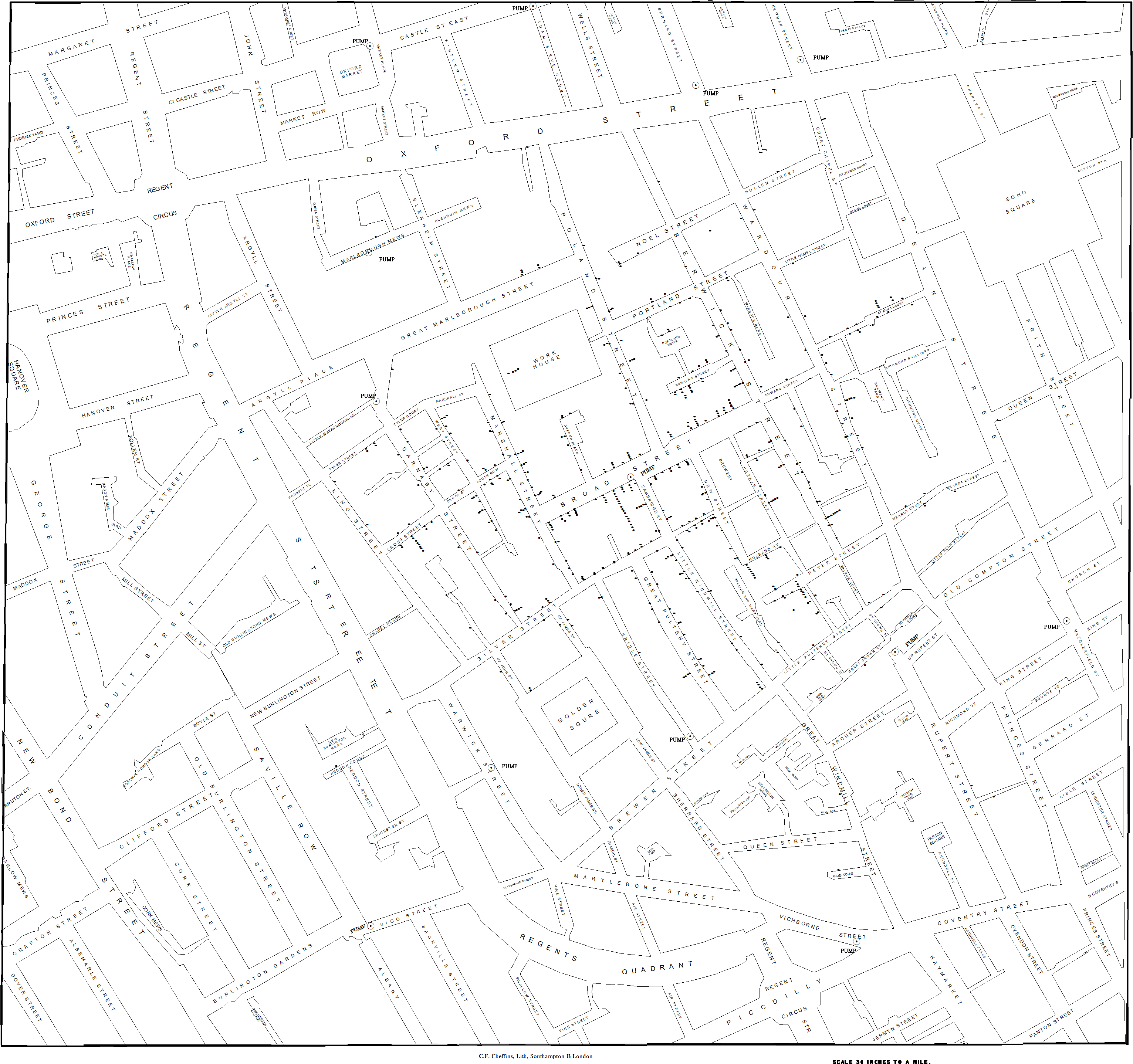
Below is my attempt at recreating John Snow’s cholera map from 1854. For those not familiar, during an cholera outbreak in London, John Snow plotted cholera cases on to a map. This helped identify clusters near water pumps leading to the connection of water quality and cholera incidence. John Snow’s map is considered one of the first examples of epidemiology and feels quite apt for my first post as I have mainly worked in public health and GIS.